South Pass
CM7. Location/Access:(36o 31.623N, 117o 32.795W). South Pass can be most easily reached by driving 15.2 miles north of CA 190 on the Saline Valley Road. The first 8 miles is paved but deteriorating. At the 8 mile mark in Santa Rosa Flat, among the Joshua Trees, there is a junction. Keep right for the remaining 7.2 miles. From this point on you are traveling through Pliocene basalt and just before the site, you enter the Jurassic Hunter Mountain Batholith. South Pass is also a junction where one can go north into the Saline Valley or continue east up to Hunter Mountain.
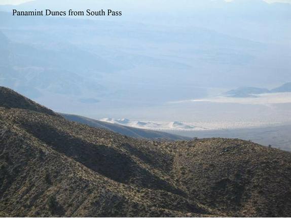
Best Time: Afternoon, all year but summer may give you a hazy view to the south (see photo).
Geology: The Hunter Mountain-Panamint Valley Fault Zone passes through here and has accommodated about 2.4mm/yr of lateral motion within the Eastern California Shear Zone (LaFemina, et. Al., 2005). [See Site FN1]. You will notice immediately south that the granitic rock is highly fractured due to motion along the fault. Note the mud and debris flow deposits just up the road to Hunter Mountain. There is also a great view down to the Panamint Dunes below.
=-=