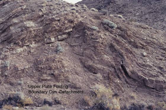
Boundary Canyon Detachment Fault/Upper Plate Folding
CD5b. Location/Access:(36o 45.002N, 116o 56.200W) This site is located an additional 1.2 miles east of Site CD5a. It is just before you reach the turnoff to Monarch Canyon (the shortest, although roughest, route to Chloride Cliff, Site GF1).
Best Time: Anytime, all year.
Geology: These are rocks of the upper plate of the Boundary Canyon detachment fault: The latest Precambrian Stirling formation and the Wood Canyon formation which straddles the Cambrian-Precambrian boundary, one of the few rocks to do so in the world. Normally this age boundary is marked by an unconformity, as seen in the Grand Canyon and many places in the Rocky Mountains. In Death Valley, however, there is a relatively unbroken sequence of deposition from the late Precambrian well into the Paleozoic. At this location and further up the hill, one can get a good look at these rocks even if they are deformed and metamorphosed a bit. This style of deformation is typical of upper plate rocks above detachment fault zones. Lower plate rocks are frequently mylonitized or otherwise ductily deformed.
=-=