--
Ibex >> Map #57
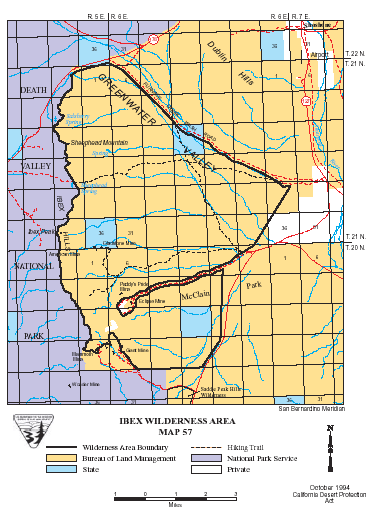
Ibex Wilderness
SIZE: 26,460 acres
LOCATION: Inyo County; 3 miles southwest of Shoshone, California
NATURAL RESOURCES: This wilderness includes portions of the Ibex Hills, Dublin Hills and Black Mountains. The Ibex Hills provide a rugged north-south divide between Greenwater Valley's alluvial slopes on the east and the Black Mountains on the west. The Black Mountains and Ibex Hills are very rugged, and their ranges ascend from 3,000 feet and rise 4,752 feet to the summit of Ibex Peak. Bright reds, yellows, browns and blacks show through the horizontal rock layers of these mountain ranges creating a distinctive affect. Evidence of historic talc mining characterizes the area, and desert bighorn sheep have been seen here.
| GLOSSARY | > alluvial fan |
ACCESS: Access this wilderness from State Highways 127 or 178.