Silverwood Lake
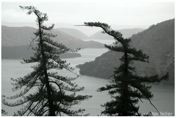
Located in between the edge of the San Bernardino National Forest and the edge of the high Mojave Desert, at an elevation of 3,350 feet above sea level, Silverwood Lake State Recreation Area captures the eye and the imagination with vistas of snow-capped mountain peaks reflected on the lake.
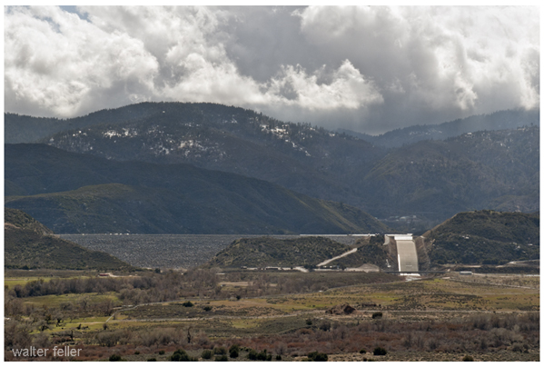
Thirty miles from San Bernardino, Silverwood Lake was formed by the 249-foot Cedar Springs Dam, which holds back the waters of the west fork of the Mojave River where it passes through the San Bernardino Mountains. Warm, dry breezes prevail during summer—with the highest temperatures averaging between 90 and 100 degrees from June to September. From December through March, rainy winter temperatures reach from the low 30s to the low 60s.
Silverwood Lake State Recreation Area (SRA) is a popular recreational area located in the San Bernardino Mountains of Southern California, USA. The history of Silverwood Lake SRA is closely tied to the development of the lake itself and the surrounding region. Here is an overview of its history:
Construction of Cedar Springs Dam:
The history of Silverwood Lake begins with the construction of Cedar Springs Dam. The dam was built by the U.S. Army Corps of Engineers and was completed in 1971. The dam was constructed across the West Fork of the Mojave River to create a reservoir, now known as Silverwood Lake.Formation of Silverwood Lake:
The completion of Cedar Springs Dam led to the formation of Silverwood Lake. The lake was intended to serve as a water storage reservoir, providing a reliable water supply for the surrounding communities and agriculture.Recreational Development:
Recognizing the recreational potential of the area, the California Department of Parks and Recreation developed the Silverwood Lake State Recreation Area around the reservoir. The park officially opened to the public in 1976.Features and Activities:
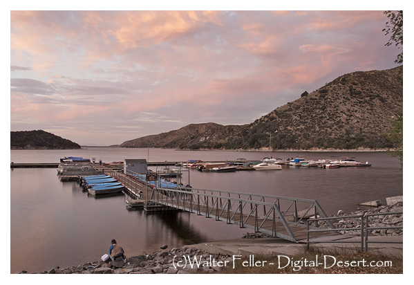
Silverwood Lake SRA offers a variety of recreational activities, including boating, fishing, hiking, camping, and picnicking. The lake itself spans over 970 acres and has become a popular destination for water-based activities.Wildlife and Natural Beauty:
The park is known for its scenic beauty, with the surrounding San Bernardino Mountains providing a picturesque backdrop. The diverse ecosystem around the lake is home to various species of wildlife, making it an attractive destination for nature enthusiasts.Visitor Facilities:
Over the years, Silverwood Lake SRA has developed visitor facilities, including campgrounds, picnic areas, and hiking trails. These facilities cater to the needs of visitors who come to enjoy the outdoor recreation opportunities offered by the park.Management and Stewardship:
The California Department of Parks and Recreation manages Silverwood Lake SRA, overseeing its day-to-day operations, maintenance, and conservation efforts to preserve the natural environment and ensure a positive experience for visitors.Overall, Silverwood Lake SRA has played a significant role in providing recreational opportunities and water resources to the surrounding communities. Its history reflects a balance between human development and the preservation of natural landscapes.
Native People
For some 2,500 years, the Serrano (Spanish for “mountain people”) Indians occupied Yahaviat (pine place) on the ...The State Water Project
... Supplying water and power for California’s agriculture, cities and industry, the Water Project also provides ...Wildlife & Habitats
California mule deer, gray foxes, coyotes, cottontail and brush rabbits, jackrabbits, western gray and ...Recreational Activities
Boating, fishing, water skiing, jet skiing, hiking, bicyling, and swimming are all popular activities. Several picnic areas surround the lake, including ...source: State of California