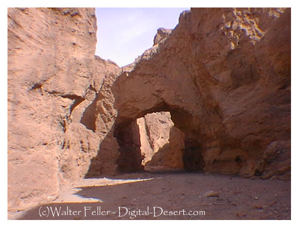
Digital-Desert : Mojave Desert Visit us on Facebook -- Desert Gazette -- Desert Link
Intro:: Nature:: Map:: Points of Interest:: Roads & Trails:: People & History:: Ghosts & Gold:: Communities:: BLOG:: Weather:: :?:: glossary

Death Valley Photos - Furnace Creek Area

Natural Bridge

photo of Natural Bridge in Death Valley This natural bridge spans 46 feet and was created by flash floods running through the wash.

Day Hikes in Death Valley
    Length : 1 mile to end of canyon, .5 mile to natural bridge.

    Difficulty : easy

    Description : Uphill walk through narrow canyon. Large natural bridge at .5 mile. Trail ends at dry waterfall.

    Start : Natural Bridge parking area. 1.5 miles off Badwater Road on gravel road, 13.2 miles south of Hwy 190.


Clickable Map of Furnace Creek Area
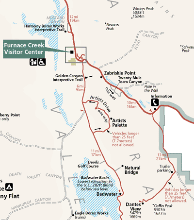
Zoom out to the Map of Death Valley

Intro:: Nature:: Map:: Points of Interest:: Roads & Trails:: People & History:: Ghosts & Gold:: Communities:: BLOG:: Weather:: :?:: glossary
Country Life Realty
Wrightwood, Ca.
Mountain Hardware
Wrightwood, Ca.
Canyon Cartography
DesertLink
Links to Desert Museums

Grizzly Cafe
Family Dining


Custom Search

AbeBooks
Abraxas Engineering
privacy
These items are historical in scope and are intended for educational purposes only; they are not meant as an aid for travel planning.
Copyright ©Walter Feller. 1995-2023 - All rights reserved.
6548