--
Mojave River Maps
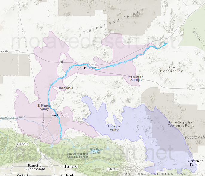
Mojave River and Morongo groundwater basins
Mojave River & Associated Lakes
There is an immense amount of water in aquifers below the earth's surface. In fact, there is a hundred times more water in the ground than is in all the world's rivers and lakes.
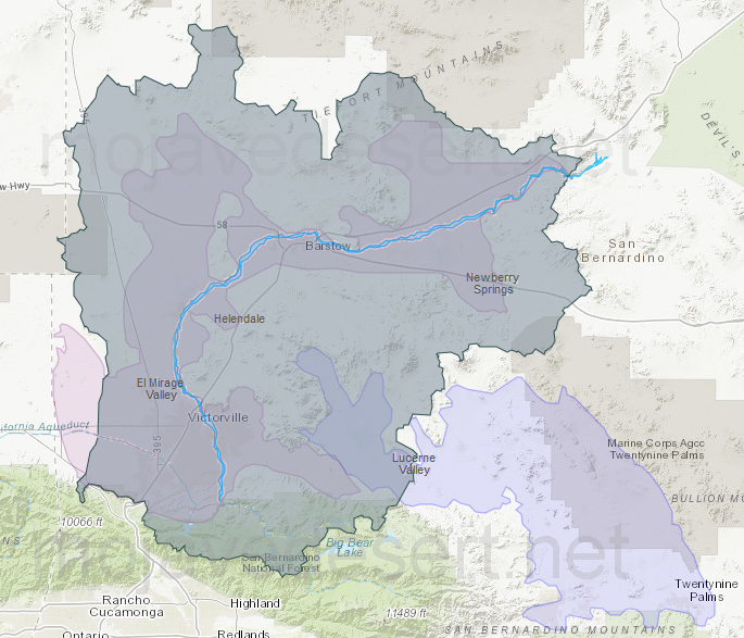
Mojave River drainage
Mojave River Drainage Ecology
Some water underlies the Earth's surface almost everywhere, beneath hills, mountains, plains, and deserts. It is not always accessible, or fresh enough for use without treatment, and it's sometimes difficult to locate or to measure and describe. This water may occur close to the land surface, as in a marsh, or it may lie many hundreds of feet below the surface, as in some arid areas of the West. Water at very shallow depths might be just a few hours old; at moderate depth, it may be 100 years old; and at great depth or after having flowed long distances from places of entry, water may be several thousands of years old.
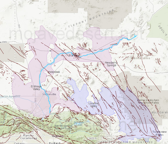
Faults along Mojave River
Earthquakes & Faults
Groundwater is a part of the water cycle. Some part of the precipitation that lands on the ground surface infiltrates into the subsurface. The part that continues downward through the soil until it reaches rock material that is saturated is groundwater recharge. Water in the saturated groundwater system moves slowly and may eventually discharge into streams, lakes, and oceans.
Here is a simplified diagram showing how the ground is saturated below the water table (the purple area). The ground above the water table (the pink area) may be wet to a certain degree, but it does not stay saturated. The dirt and rock in this unsaturated zone contain air and some water and support the vegetation on the Earth. The saturated zone below the water table has water that fills the tiny spaces (pores) between rock particles and the cracks (fractures) of the rocks.
TEMP - USGS
California Water Science Center: USGS