Blackhawk Landslide
Geologic Setting
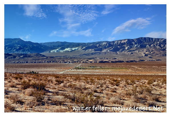
The landslide sits at the base of Blackhawk Mountain, on the north slope of the San Bernardino Mountains, overlooking Lucerne Valley. The bedrock there is mostly Cambrian marble that had been thrust over weaker gneiss and sandstone. This structural setup, with a heavy block resting on softer layers, created long-term instability. Faulting and seismic activity in the area likely played a role in weakening the slope before failure.Timing and Trigger
The Blackhawk Landslide is generally dated to the late Pleistocene, about 17,00020,000 years ago. This places it near the end of the last glacial period, when the Mojave climate was wetter and slopes may have been destabilized by freeze-thaw cycles, groundwater saturation, or even earthquakes. Some researchers suggest a large seismic event could have been the trigger.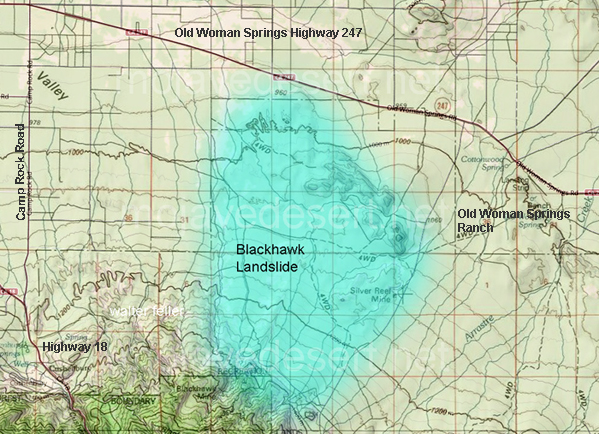
Mechanics of Movement
The landslide is famous because it traveled an unusually long distance for the volume of materialaround 5 miles across relatively flat desert. The leading theory is air cushioning, where shattered rock fragments entrained and trapped air beneath the slide, reducing friction. This would have allowed it to behave like a fluidized mass, moving at high velocity. Experimental models and modern analogs support this idea, though some geologists also point to the possibility of basal melting of calcite in the marble, creating a slick surface.Morphology of the Deposit
The landslide left a striking fan-shaped lobe of broken marble breccia. Its 2 miles wide, 5 miles long, and up to 100 feet thick. Surface features include:Flow ridges resembling moraines.
Jigsaw fractures in marble blocks.
Terminal ridges marking where the mass finally came to rest.
It is so well preserved because the desert climate minimizes erosion, essentially freezing the moment of collapse in stone.
Comparison to Other Landslides
The Blackhawk is often compared with the Elm Landslide (Switzerland, 1881) and the Frank Slide (Canada, 1903). Both involved carbonate rocks collapsing catastrophically, but the Blackhawks scale and preservation are greater. Its also used as a textbook case of a sturzstrom (long-runout landslide), a rare category of landslides that move extraordinary distances relative to their drop height.Associated Features
Nearby lies the Silver Reef, an older and smaller slide, suggesting repeated slope failures in this sector of the San Bernardino Mountains. Together, they show the regions long-term instability tied to tectonics, rock composition, and erosion.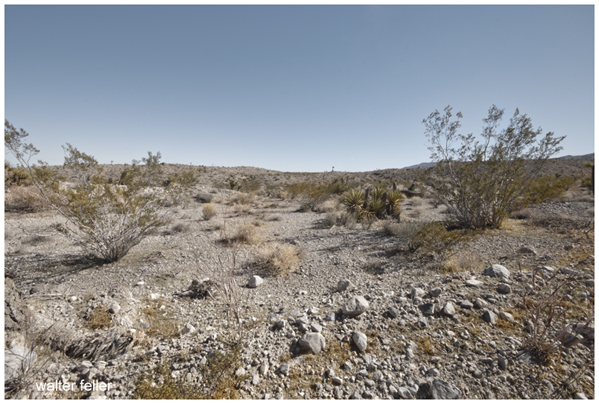
Scientific Importance
The Blackhawk Landslide is one of the best-preserved examples of a sturzstrom in North America. Its study has influenced theories on long-runout landslides worldwide, from volcanic collapses to Himalayan slope failures. Because of its desert setting, the deposits remain highly visible, making it a natural laboratory for landslide mechanics.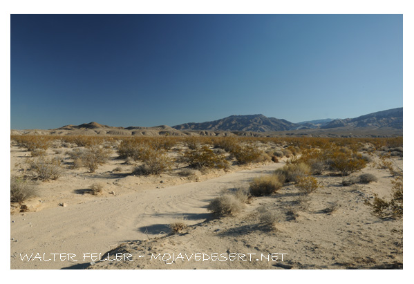
Also see:
Mojave Desert Geology
The study of the history of the physical development of the structure, content and life of the earth by application of ...
Ecology: