Subsection 322Aj
Kingston Range - Valley Wells
This subsection includes mountains, hills, pediments, and high alluvial plains
between Silurian Valley and Devil’s Playground on the west and southwest,
California Valley on the northwest, Pahrump Valley on the north, Mesquite
Valley and Ivanpah Fault on the northeast, and Ivanpah Valley on the southeast,
plus the southern part of the Spring Mountains. The subsection is
on about half upland and half alluvial plain. It has a hot,
arid climate that is moderated by elevation on the higher mountains.
MLRAs 29f and 30g.
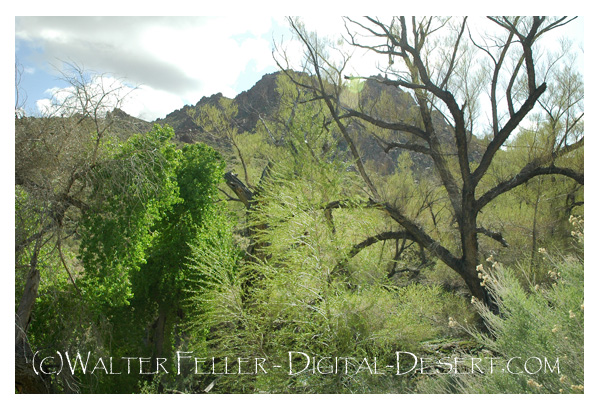
Photo - Kingston Peak
Lithology and Stratigraphy. The upland in this subsection contains mainly Mesozoic granitic, Quaternary volcanic, Paleozoic marine sedimentary, and Precambrian sedimentary and metamorphic rocks. There are Pleistocene and recent basalt flows along the ridge on the east side of Shadow Valley. The alluvial plain is mostly fluvial deposits, with a small area of lacustrine deposits at Valley Wells in Shadow Valley.
Geomorphology. This subsection is on steep to very steep mountains, gently to moderately sloping pediments and alluvial fans, and nearly level basin floor. Some of the pediments are capped by Quaternary lava flows, and there are many volcanic cones on the flows. The mountains and ridges are oriented north-south or toward the north-northwest. The elevation range is about 1000 to 4000 feet on alluvial plains and up to 7324 feet in the Kingston Range and 7929 feet on Clark Mountain. Mass wasting, fluvial erosion and deposition, and volcanism are the main geomorphic processes.
Soils. The upland soils are mostly Lithic Torriorthents, plus Lithic Camborthids on granitic rocks and Lithic Haplargids on volcanic rocks. At higher elevations, the upland soils are Lithic Xeric Torriorthents, shallow Xeric Torriorthents, and shallow Xeric Haplargids; shallow Aridic Argixerolls are less common. Soils on alluvial plains are mostly Typic Torriorthents and Typic Torripsamments on younger fans and Typic Calciorthids and Typic Haplargids on older fans. The soils are well drained. Soil temperature regimes are mostly thermic, and mesic at higher elevations. Soil moisture regimes are aridic.
Vegetation. The predominant natural plant communities are Creosote bush series on fans, Shadscale series on lower mountain slopes, Singleleaf pinyon series on higher mountain slopes, and White fir series on the highest mountains. Joshua tree series is common on alluvial plains. Black bush series occurs on mountain slopes.
- Characteristic series by lifeform include:
Grasslands: Alkali sacaton series, Big galleta series, Indian ricegrass series, Saltgrass series.
Shrublands: Big sagebrush series, Bitterbrush series, Black bush series, Black sagebrush series, Brittlebrush series, Catclaw acacia series, Creosote bush series, Creosote bush - white bursage series, Desert-holly series, Fourwing saltbrush series, Greasewood series, Hop-sage series, Iodine bush series, Joshua tree series, Mixed saltbush series, Nolina series, Scadscale series, White bursage series.
Forests and woodlands: Mesquite series, Singleleaf pinyon series, Singleleaf pinyon - Utah juniper series, Utah juniper series, White fir series.
Surface Water. Runoff is rapid from mountains and alluvial fans and slow from basin-fill. Most of the runoff drains to closed basin around the subsection. Runoff from Valley Wells is through Kingston Wash to Silurian Valley. Streams are dry most of each year; water flows in few of them except following intense rain. There is temporary ponding on playas, or dry lake beds.
< previous - Mojave Desert - next >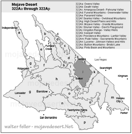
clickable map - select a section to view