San Gabriel Mountains
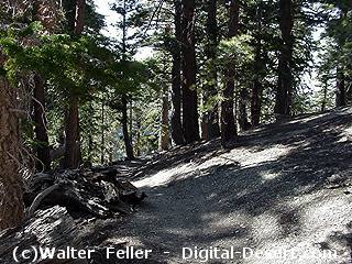
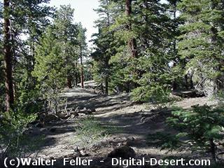
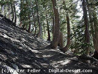
Hiking Trails in the High Country
These trails are only a few of the many, varied hiking, cycling and equestrian experiences you can enjoy on the Angeles National Forest.Name
Distance (Round Trip), Elevation Gain, Difficulty
Charlton Flat to Vetter Mountain
3 miles, 400 feet, EasyCharlton Flat to Mt. Mooney and Devil's Peak
1 1/2 miles 250 feet EasyIslip Saddle to Little Jimmy and Mt. Islip
6.1 miles, 1,250 feet, Easy to ModerateBuckhorn to Cooper Canyon and Littlerock Creek
4 1/2 miles, 900 feet, ModerateChilao to Mt. Hillyer via Horse Flats
6 miles, 1,000 feet, ModerateEagles Roost to Littlerock Creek
7 miles, 1,100 feet, ModerateBuckhorn to Mt. Waterman
7 miles, 1,300 feet, ModerateVincent Gap to Prairie Fork
8.8 miles, 2,000 feet, ModerateKenyon Devore Trail to Mt. Wilson
9 miles, 2,600 feet, ModerateIslip Saddle to Mt. Williamson
5 miles, 1,600 feet, ModerateDawson Saddle to Throop Peak
4 miles, 1,200 feet, ModeratePrairie Fork to Upper Fish Fork
8 miles, 1,000 feet, ModerateCrystal Lake to Mt. Islip
7 1/4 miles, 2,200 feet, ModerateCrystal Lake to Mt. Hawkins
10 miles, 2,800 feet, ModerateIcehouse Canyon to Icehouse Saddle
7 1/4 miles, 2,600 feet, ModerateBaldy Notch to Mt. San Antonio
6 1/2 miles, 3,500 feet, ModerateChilao to Devil's Canyon
7 miles, 1,500 feet, Moderate to StrenuousVincent Gap to Mt. Baden-Powell (elevation 9,399')
8 miles, 2,800 feet, Moderate to StrenuousThree Points to Twin Peaks Saddle, Mt. Waterman and Buckhorn
11.8 miles, 3,700 feet, StrenuousBlue Ridge to Mt. San Antonio (Mt. Baldy)
10 miles, 3,000 feet, Very Strenuous
|
The Angeles National Forest offers 557 miles of hiking and equestrian trails which include 73 miles of National Recreation Trails and 176 miles of the Pacific Crest Trail (PCT). These trails offer ample choices for all, from beginners to experienced outdoor enthusiasts.
All trails, except the PCT and those in Wilderness Areas, are open to mountain bikes. Be careful and alert! Mountain bikes must yield the right-of-way to hikers and horses.
Before beginning any hike!
- Take into account your time available.
- Have a good knowledge of the area (maps help!).
- Check out the weather for the area you will be hiking in and dress appropriately. Take extra clothing and the necessary equipment (dont forget water). The time of year will help determine your needs for your trip.
- Consider what the terrain is like where you're going.
- Check with a local Forest Service office for information concerning trail conditions and fire restrictions.
- Please leave the Forest clean - dispose of your trash in trash receptacles or bring it back with you.
- Keep the wildlife "wild". Please never feed the wildlife, and watch and enjoy from a distance!
- Let family or friends know where you are going and when you expect to return.
- Small shovel or trowel for sanitation.
- Whistle (3 blasts is a distress signal). Please use the whistle only in an emergency!
- Flashlight
- First aid kit
- Snakebite kit
- Pocket knife
- Dark glasses and sunscreen lotion
- Waterproof matches