Blue Ridge Summit
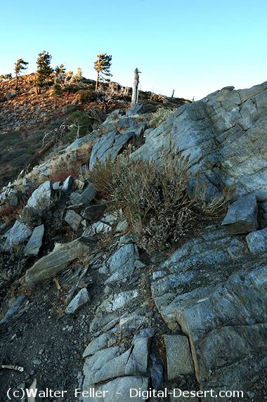
Blue Ridge Summit (7,360') is where the Angeles Crest Highway, SR2, gains its highest elevation while crossing the Blue Ridge.Blue Ridge is named for the color of the rock, the distinctive blue-gray Pelona schist. Interestingly, the Orocopia Mountains (east of Mecca, CA and just north of the Salton Sea), 160 miles (257 km) away along the San Andreas Fault, have a virtually-identical rock, the Orocopia Schist. In 1953, this displacement led Hill and Dibblee to suggest that a total of ~350 miles of displacement have occurred along the San Andreas Fault since its birth ~11 million years ago. This was received as an outrageous claim at the time, but further work substantiated their claim. (An entire suite of rocks in the San Gabriel Mountains, on one side of the San Andreas Fault, complete with their ancient faults, is almost perfectly duplicated in the Orocopia Mountains, on the other side of the Fault.)
At the summit, on the north side of the road, is a large trailhead parking lot for the Pacific Crest Trail complete with restrooms. Also on the north side is a nature trail circling Lightning Ridge with an incredible display of wildflowers for much of the year. To the southwest is Inspiration Point, a not-to-be-missed vista overlooking the East Fork of the San Gabriel River, Mt. Baldy and Mt. Baden-Powell. (See calculated elevation angles and azimuthal angles to visible features from Lightning Ridge.) To the southeast is an electronic site and the Blue Ridge Road, the access for hiking Wright / Pine / Dawson / Baldy Mtns., the northern Devil's Backbone Trail.
Access
Map: Mt. Islip Region (89 near the right edge of the map)
See also: USGS 7.5' x 7.5' Map: Mount San Antonio (34° 22' 18" N, 117° 42' 32" W)
By Car: East from Big Pines, 1.7 miles, on Angeles Crest Highway, SR2. East from the Blue Ridge Fire Road.
By Trail: On the Pacific Crest Trail west from Grassy Hollow and east from Wrightwood. North from a trail around Lightning Ridge.
Season: Snow closure in winter.
Hiking notes:
No. RT miles Elev. gain Season Name
89 1 200 jun-oct Lightning Ridge Nature Trail
89.1 4.5 1000 jun-oct Blue Ridge Trail
89.2 2.3 250 may-nov Blue Ridge Road to Mtn. High West via Ski Lift Access Road
93 11 4600 jun-oct Blue Ridge to Pine and Dawson Mtns. and Mount San Antonio
Source: J. Strong & T. Chester
Hiking Trails
Blue Ridge to Mount San Antonio (Mount Baldy)
For a High Country trip encompassing the three highest peaks in the San Gabriel Mountains and the ...
|
Lightning Ridge