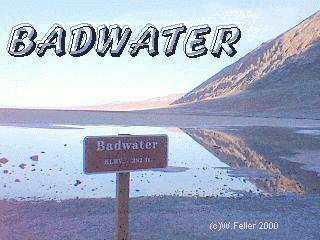
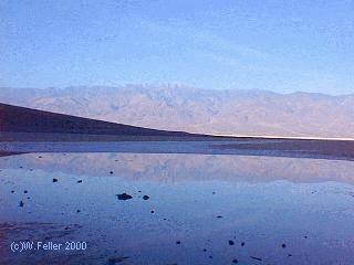
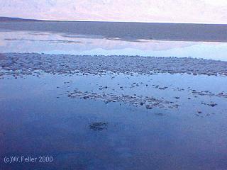
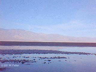
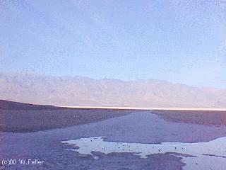
Badwater
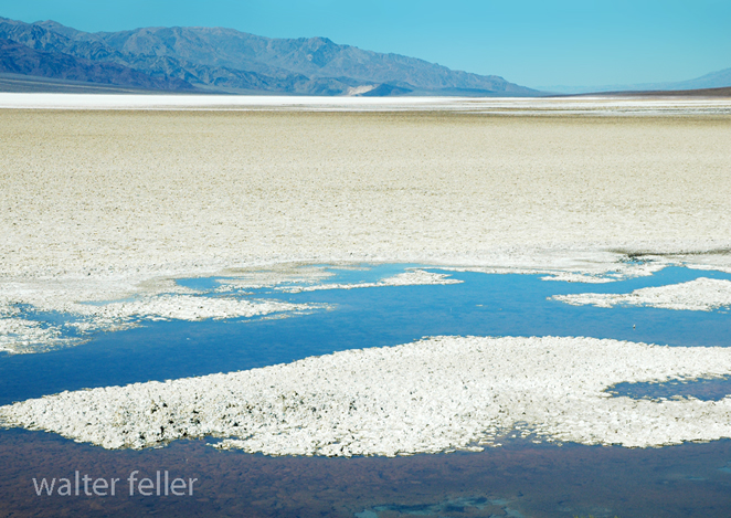
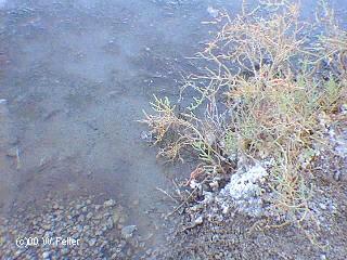
Badwater is the lowest elevation in the western hemisphere you can drive to. The actual lowest point, 282 feet below sea level is further out in the pan, several miles to the west. Dante's View is one mile away, straight up. The water has a definate odor to it. Brine flies, shrimp and several types of plants survive in this salty, alkaline environment.
Title: Badwater, Death Valley: Exploring the Hottest and Lowest Point in North America
Introduction:
Situated in the heart of Death Valley National Park, Badwater stands as a testament to the extreme conditions that Mother Nature can conjure. This unique location, known for its scorching temperatures and below-sea-level elevation, offers a fascinating glimpse into the harsh realities of one of Earth's most inhospitable environments. In this blog post, we will delve into the intriguing characteristics of Badwater, Death Valley, and uncover the captivating stories that lie beneath its surface.
1. The Lowest Point in North America:
Nestled at an elevation of 282 feet (86 meters) below sea level, Badwater Basin claims the title of the lowest point in North America. This vast salt flat, stretching over 200 square miles (518 square kilometers), is a sight to behold. The unique geological formations and the striking contrast between the pure white salt crystals and the surrounding barren landscape create a mesmerizing visual experience.
2. The Mysteries of Salt Flats:
The salt flats of Badwater Basin are a result of the evaporation of ancient lakes that once covered this region. The accumulated salt deposits have created a surreal landscape, with intricate salt polygons and salt pinnacles that add an otherworldly touch to the scenery. The reflection of the sun's rays on the salt crystals creates a dazzling effect, making it a photographer's paradise.
3. The Brutal Heat:
Death Valley, including Badwater, holds the record for the highest temperature ever recorded on Earth, a scorching 134 degrees Fahrenheit (57 degrees Celsius). The combination of the low elevation and the surrounding mountain ranges traps the heat, creating a natural oven that challenges the limits of human endurance. Exploring Badwater during the summer months requires careful planning, as the heat can be life-threatening.
4. Unique Flora and Fauna:
Despite the harsh conditions, Badwater and its surroundings are home to a surprising array of plant and animal life. Desert vegetation such as salt-tolerant plants and wildflowers manage to thrive in this unforgiving environment. The saline pools and spring-fed ponds in the area also provide a haven for endemic species like the endangered pupfish, adding to the ecological significance of Badwater.
5. Beyond Badwater: Death Valley National Park:
While Badwater is undoubtedly a highlight of Death Valley National Park, this vast park has much more to offer. From the towering sand dunes of Mesquite Flat to the otherworldly landscapes of Devil's Golf Course and Artist's Palette, the park is a treasure trove of natural wonders. Exploring the canyons, hiking the trails, and experiencing the starry night skies make for unforgettable adventures in this unique desert ecosystem.
Conclusion:
Badwater, Death Valley, stands as a testament to the extremes of nature, showcasing the lowest and hottest point in North America. Its surreal salt flats, brutal heat, and unique flora and fauna make it a captivating destination for adventurers and nature enthusiasts alike. As you explore the wonders of Badwater and the surrounding Death Valley National Park, be prepared to be amazed by the resilience of life in the face of adversity and the sheer beauty that emerges from one of the harshest environments on Earth.
| GLOSSARY | > alkali, pan |
Also see: Death Valley Geology - Badwater
 -
- 
 -
- 
 -
- 
Clickable Map of Furnace Creek Area
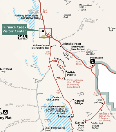 Zoom out to the Map of Death Valley