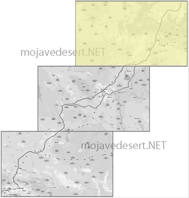
Virgin River Section
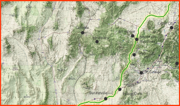
North of Mountain Meadows, the Old Spanish Trail entered a country of changing elevations, broken drainage, and increasingly dry ground. Mountain Meadows itself was valuable because it offered dependable water, grass, and a place to rest stock before the difficult descent toward the warmer country south and west. From there the Northern Route followed the upper branches of the Santa Clara River through the Central, Veyo, and Gunlock country, then continued toward Camp Spring and the Shivwits country. Water and feed, rather than a surveyed line, governed the exact route; travelers sometimes used different approaches to the Santa Clara and Virgin rivers.
The land records a meeting of major geologic provinces. Volcanic uplands and sedimentary valleys around Mountain Meadows gave way to the dry washes, tilted strata, and fault-broken limestone ridges of the Beaver Dam Mountains. This rugged range lies near the transition between the Colorado Plateau and Basin and Range country. Its steep, shattered slopes forced pack trains and later wagons to seek practical crossings instead of a direct course. Beyond the mountains, the trail dropped into the lower Virgin River valley, where erosion had cut broad sandy bottoms and, farther south, the deep Virgin River Gorge.
Ecologically, this was a hard desert route relieved by narrow river oases. The uplands carried Joshua trees, desert shrubs, and scattered grasses. Along the Santa Clara and Virgin rivers, cottonwoods, willows, mesquite, reeds, and other riparian growth offered shade, browse, wood, and limited grazing. The contrast mattered greatly to people traveling with animals: a green river bottom could sustain a camp, while the next stretch of dry gravel, cactus, and open desert might offer little water or forage. Southern Paiute people knew these water sources, plant communities, and travel corridors long before Mexican and American travelers used them. The Virgin River still supports unusual desert riparian habitat, including native fish and spring-dependent species.
This section carried several generations of traffic. Mexican traders used the Old Spanish Trail in the 1830s and 1840s, moving woven New Mexican goods west and returning with California horses and mules. John C. Fremont crossed the Beaver Dam Mountains and traveled up the Santa Clara country in 1844. After 1847, Jefferson Hunt and other Mormon travelers helped turn the older pack-trail corridor into the Mormon Road, a rough wagon route between Salt Lake and southern California. In 1849, Hunt's San Joaquin Company broke apart near the Enterprise-Mountain Meadows country when many emigrants chose an unproven shortcut; those who stayed with Hunt continued on the established road. Bunkerville, settled in 1877, came later, but its Virgin Valley location preserves the course of this old transportation corridor.
References
Bureau of Land Management - Old Spanish National Historic Trail, UtahUtah Geological Survey - Ancient Landslides of the Beaver Dam Mountains
Utah Historical Society - In Search of the Spanish Trail
Nevada State Historic Preservation Office - Virgin Valley marker
National Park Service - The Lost '49ers
Beaver Dam Mountains Wilderness