June Lake Loop

June Lake Loop is a scenic drive located in the Eastern Sierra region of California, USA. It's known for its breathtaking natural beauty and outdoor recreational opportunities. The loop is approximately 16 miles long and takes you through the stunning alpine landscapes of the Eastern Sierra.
Key highlights and attractions along the June Lake Loop include:
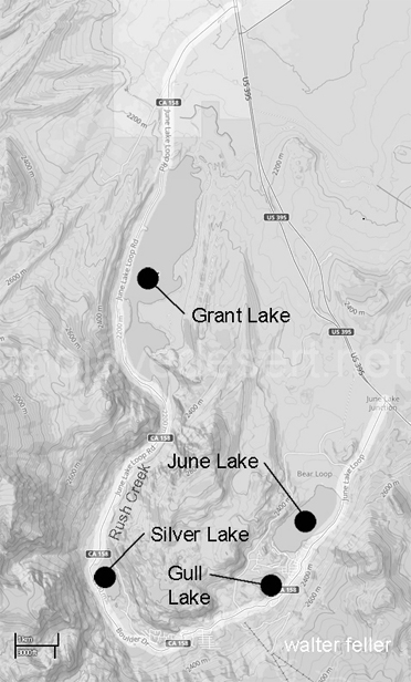
1. June Lake: The loop starts and ends at the charming town of June Lake, which is situated along the shores of the picturesque June Lake. You can enjoy fishing, swimming, and boating in the lake.
2. Gull Lake: This is another beautiful lake along the loop, offering opportunities for fishing and water-based activities.
3. Silver Lake: Silver Lake is one of the larger lakes in the area and is a popular spot for fishing and picnicking.
4. Grant Lake: This reservoir is known for its scenic views and is also a great place for fishing and boating.
Overall, the June Lake Loop is a scenic byway that provides visitors with access to the stunning natural beauty of the Eastern Sierra, making it a popular destination for both outdoor enthusiasts and those looking for a peaceful getaway in nature.
Geology
How Nature Built the June Lake Loop The June Lake Loop in Californias Eastern Sierra didnt just show up overnight. Its the result of some serious earth-shaping forces that worked together over millions of years. What you see todaytowering mountains, sparkling lakes, and rugged cliffsis natures handiwork, carved and molded by time, ice, fire, and rock.1. Mountains on the Rise
The Sierra Nevada is a huge block of granite thats been slowly tilting and lifting up on its eastern side. Thats why the mountains rise so steeply above the June Lake area. Its like one end of a giant table being slowly jacked up.
2. Ice Did the Carving
Long ago, giant glaciers flowed down these valleys, scraping and carving everything in their path. When the ice melted, it left behind deep bowls and valleysperfect for lakes. Thats how June, Gull, Silver, and Grant lakes were formed. You can still see the clues in the smooth rocks and curving ridges around the loop.
3. Fire in the Earth
Just a short drive from the loop are craters and lava domes that remind us this land was once full of volcanic fire. Explosive eruptions left behind ash, pumice, and even shiny black obsidian. That volcanic soil helps give the area its unique feeland great fishing too.
4. Shaking Things Up
This whole area is still alive with movement. Faults run beneath the land, and every now and then, earthquakes remind us that the Earth is still shifting. Thats part of what makes this landscape so dramaticit's being pulled and stretched like dough.
5. Rock Stars
Most of the tall peaks around here, like Carson Peak, are made of graniterock that formed deep underground and was later pushed up. Lower areas and nearby Mono Basin have more volcanic rock, giving the region a mix of colors, shapes, and textures.
In a nutshell:
The June Lake Loop is like a natural masterpiece, shaped by rising mountains, powerful glaciers, ancient volcanoes, and the ever-shifting Earth. Its beautiful, a little wild, and full of stories written in stone.
US 395
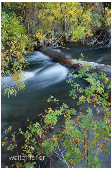
Rush Creek