Warm Spring
SV2. Location/Access:(36o 48.353’N, 117o 46.420’W). If coming from Waucoba Spring, continue south along the Saline Valley road for 17 miles. Turn east and travel 6.7 miles to the spring. If coming from the south, which would be required in winter and would be more direct from CA 190, turn north at South Pass (CM7) and head down the canyon. The first five miles, one is traveling down the canyon along the Hunter Mountain fault zone and crushed granitic rock is obvious at many places. For the next nine miles, the road is descending a broad bajada which is often very rocky. At about the 10-mile point, there is a large pile of rocks denoting the back road up to the Racetrack. At 21 miles into the ordeal, one sees the abandoned tramway that was once used to haul salt up and over the Inyo Mountains to the Owens Valley. The economic viability of this activity has always escaped us. At 29.7 miles, turn right and travel the 6.7 miles to the spring.
Best Time: Any time of day but avoid summer.
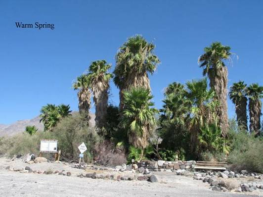
Geology: That there is a warm spring here is not surprising as you can see the obvious Neogene and Pleistocene basalt outcrops both just north and south of the spring area. Also, you will notice a chain of smaller springs heading south from the main developed spring. This is the trace of a fault zone. Mase, et. Al. (1979) report that the average heat flow in the area is consistent with heat flows from surrounding areas of the Great Basin. Thus one must conclude the fault is the dominant cause for the location of the warm spring. According to the previous reference, the spring discharges about 20 liters per minute at an average temperature of 40oC. Most of the white spring deposits in the immediate vicinity are calcite. Since much of the surrounding mountains contain limestone, circulating groundwater with dissolved calcite is not surprising. Most of the mountains surrounding the valley are highly folded Paleozoic sedimentary rocks and some Jurassic plutonic rocks. A second spring lies about 1/2 mile up the Steele Pass road. Restoration at Warm Spring has been remarkably slow considering it has been in the national park since 1994.