Emigrant Pass
SE4. Location/Access:(35o 53.063N, 116o 03.865W) From the CA 127-178 junction near Shoshone, go 5.1 miles south. Turn east towards Tecopa and through the Hot Springs to the junction in Tecopa (now 4.3 miles from CA 127). Turn east and go 1.4 miles to the Old Spanish Trail/Furnace Creek Road junction (the main road actually curves to the left). Continue 8.6 miles towards Nevada on the Old Spanish Trail Road and stop before the summit of the pass on the right shoulder.
Best Time: Anytime, all year.
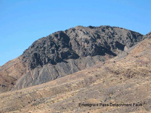
Geology: The GPS coordinates are set on a small outcrop of the Cambrian Carrara formation. You can find some decent trilobites here (at least 6 species of Olenellus and several others). There is a good detachment fault visible to the northwest (see photo) and algal laminated bodies (Girvanella) can be found in the Zabriskie quartzite 0.4 miles back down the hill (Licari, 1999).
Old Spanish Trail
The trail connected New Mexicos frontier colonies to their counterparts in southern California in the early ...=-=