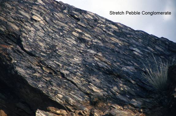
Stretch-Pebble Conglomerate
NP7. Location/Access:(36o 18.633N, 117o 09.036W) This outcrop is located directly on the Wildrose Road just past Nemo Crest, 3.9 miles south of the Wildrose Roads junction with the Augerberry Point road or 5.2 miles past the Wildrose Road junction with the road to the Charcoal Kilns. Parking is a problem so you may have to park either uphill or downhill from the site itself. Watch for traffic on the curves as you examine the outcrop.
Best Time: Anytime, all year.
Geology: This outcrop is mapped by Walker, et. Al. (2002) as part of the Proterozoic Kingston Peak formation. By the way, this is an excellent recent geologic map for exploring the southwestern part of Death Valley National Park. Because of Mesozoic plutonic intrusions, Neogene extension and related igneous intrusions, and mid- and late Paleozoic compression, etc., many of the sedimentary rocks in Death Valley have been metamorphosed. This rock was once a sedimentary conglomerate composed of cemented pebble-size fragments. During middle-grade metamorphism, perhaps during ductile deformation related to detachment faulting, the particles were thinned and stretched into what you see here.
=-=