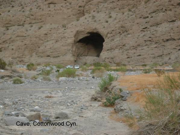
Cottonwood Canyon/Cave
NP4b. Location/Access:(36o 34.802N; 117o 18.697W) The cave is located 6.2 miles past the canyon mouth and a total of 14.6 miles from Stovepipe Wells. Past the mouth of the canyon, the road has been in terrible shape for many years and for the first few miles, you will have to drive up the bottom of the wash dodging boulders as you go. Fortunately, the road is neither steep nor sandy. The cave is not very visible when you are traveling up the canyon as it will be behind you and to the left. It will be very obvious upon your return from the end of the canyon.
Best Time: Anytime in the cool half of the year.
Geology: This is a quite unusual cave as it does not have a karst origin, i.e.: it wasnt created by groundwater dissolution of limestone or similar rock. The cave is in poorly indurated Pleistocene alluvial fanglomerate. Although groundwater must have played a role in its origin, that role was limited to removal of cementing agents between fan gravel particles. Further, mass wasting has obviously played a role in its development because of the piles of debris at the entrance and center of the cave that have fallen from the ceiling. There are a few small faults with slickensides and water seeps visible on the higher walls and ceiling. This probably explains why the seeping groundwater did its sapping at this location. The rock deposit in which the cave can be found probably filled most of the wide portion of the canyon between this point and the narrows above the canyon mouth. The canyon is wide in this area because this rock unit is far easier to erode than the bedrock immediately up canyon from here. As to why this rock unit was deposited here to begin with requires more research but it seems probable that this site was once the apex area of a large fan system that has since been eroded. From this point, the canyon becomes narrower and Paleozoic carbonates dominate as you ascend.
=-=