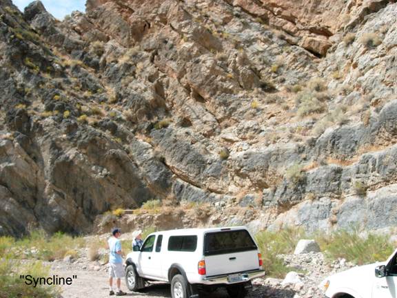
Titus Canyon/Syncline
GF2d. Location/Access:(36o 51.180N; 117o 03.790W) The syncline is located a very short distance (0.4 miles) down the canyon from Leadfield or 15.6 miles from the pavement.
Best Time: Anytime.
Geology: What appears to be an asymmetric syncline within the Bonanza King formation is actually an optical illusion. The rocks are all dipping rather uniformly but erosion by water formed a sharply turning canyon wall producing the illusion (see p. 23, Stop 5 in Brandt, 1992). This is also a good place to examine nearly all of the rocks that form the valley walls of upper Titus Canyon because they can all be found as eroded cobbles and boulders on the floor of the wash. Especially notable are the boulders of water-worn conglomerate from the Titus Canyon formation. From this point on, the road will travel along the canyon bottom and the canyon becomes increasingly narrow and a roofless vehicle offers a spectacular ride to the end of the canyon.
=-=