THE VALLEY OF THE COLORADO
(from; CANYONS OF THE COLORADO BY J. W. POWELL, PH.D., LL.D. - First published 1895)The Colorado River is formed by the junction of the Grand and Green.
The Grand River has its source in the Rocky Mountains, five or six miles
west of Long's Peak. A group of little alpine lakes, that receive their
waters directly from perpetual snowbanks, discharge into a common
reservoir known as Grand Lake, a beautiful sheet of water. Its quiet
surface reflects towering cliffs and crags of granite on its eastern
shore, and stately pines and firs stand on its western margin.
The Green River heads near Fremont's Peak, in the Wind River Mountains.
This river, like the Grand, has its sources in alpine lakes fed by
everlasting snows. Thousands of these little lakes, with deep, cold,
emerald waters, are embosomed among the crags of the Rocky Mountains.
These streams, born in the cold, gloomy solitudes of the upper mountain
region, have a strange, eventful history as they pass down through
gorges, tumbling in cascades and cataracts, until they reach the hot,
arid plains of the Lower Colorado, where the waters that were so clear
above empty as turbid floods into the Gulf of California.
The mouth of the Colorado is in latitude 31 degrees 53 minutes and
longitude 115 degrees. The source of the Grand River is in latitude 40
degrees 17' and longitude 105 degrees 43' approximately. The source of
the Green River is in latitude 43 degrees 15' and longitude 109 degrees
54' approximately.
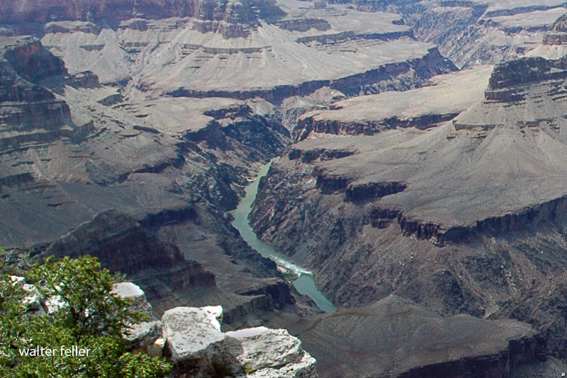
 Grand Canyon - Mohave Point
The Green River is larger than the Grand and is the upper continuation
of the Colorado. Including this river, the whole length of the stream is
about 2,000 miles. The region of country drained by the Colorado and its
tributaries is about 800 miles in length and varies from 300 to 500
miles in width, containing about 300,000 square miles, an area larger
than all the New England and Middle States with Maryland, Virginia and
West Virginia added, or nearly as large as Minnesota, Wisconsin, Iowa,
Illinois, and Missouri combined.
There are two distinct portions of the basin of the Colorado, a desert
portion below and a plateau portion above. The lower third, or desert
portion of the basin, is but little above the level of the sea, though
here and there ranges of mountains rise to an altitude of from 2,000 to
6,000 feet. This part of the valley is bounded on the northeast by a
line of cliffs, which present a bold, often vertical step, hundreds or
thousands of feet to the table-lands above. On the California side a
vast desert stretches westward, past the head of the Gulf of California,
nearly to the shore of the Pacific. Between the desert and the sea a
narrow belt of valley, hill, and mountain of wonderful beauty is found.
Over this coastal zone there falls a balm distilled from the great
ocean, as gentle showers and refreshing dews bathe the land. When rains
come the emerald hills laugh with delight as bourgeoning bloom is spread
in the sunlight. When the rains have ceased all the verdure turns to
gold. Then slowly the hills are brinded until the rains come again, when
verdure and bloom again peer through the tawny wreck of the last year's
greenery. North of the Gulf of California the desert is known as
"Coahuila Valley," the most desolate region on the continent. At one
time in the geologic history of this country the Gulf of California
extended a long distance farther to the northwest, above the point where
the Colorado River now enters it; but this stream brought its mud from
the mountains and the hills above and poured it into the gulf and
gradually erected a vast dam across it, until the waters above were
separated from the waters below; then the Colorado cut a channel into
the lower gulf. The upper waters, being cut off from the sea, gradually
evaporated, and what is known as Coahuila Valley was the bottom of this
ancient upper gulf, and thus the land is now below the level of the sea.
Between Coahuila Valley and the river there are many low, ashen-gray
mountains standing in short ranges. The rainfall is so little that no
perennial streams are formed. When a great rain comes it washes the
mountain sides and gathers on its way a deluge of sand, which it spreads
over the plain below, for the streams do not carry the sediment to the
sea. So the mountains are washed down and the valleys are filled. On the
Arizona side of the river desert plains are interrupted by desert
mountains. Far to the eastward the country rises until the Sierra Madre
are reached in New Mexico, where these mountains divide the waters of
the Colorado from the Rio Grande del Norte. Here in New Mexico the Gila
River has its source. Some of its tributaries rise in the mountains to
the south, in the territory belonging to the republic of Mexico, but the
Gila gathers the greater part of its waters from a great plateau on the
northeast. Its sources are everywhere in pine-clad mountains and
plateaus, but all of the affluents quickly descend into the desert
valley below, through which the Gila winds its way westward to the
Colorado. In times of continued drought the bed of the Gila is dry, but
the region is subject to great and violent storms, and floods roll down
from the heights with marvelous precipitation, carrying devastation on
their way. Where the Colorado River forms the boundary between
California and Arizona it cuts through a number of volcanic rocks by
black, yawning canyons. Between these canyons the river has a low but
rather narrow flood plain, with cottonwood groves scattered here and
there, and a chaparral of mesquite bearing beans and thorns. Four
hundred miles above its mouth and more than two hundred miles above the
Gila, the Colorado has a second tributary--"Bill Williams' River" it is
called by excessive courtesy. It is but a muddy creek. Two hundred miles
above this the Rio Virgen joins the Colorado. This river heads in the
Markagunt Plateau and the Pine Valley Mountains of Utah. Its sources are
7,000 or 8,000 feet above the sea, but from the beautiful course of the
upper region it soon drops into a great sandy valley below and becomes a
river of flowing sand. At ordinary stages it is very wide but very
shallow, rippling over the quicksands in tawny waves. On its way it cuts
through the Beaver Mountains by a weird canyon. On either side
grease-wood plains stretch far away, interrupted here and there by
bad-land hills.

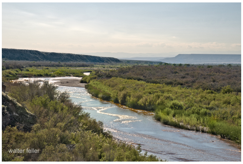
Virgin River
The region of country lying on either side of the Colorado for six
hundred miles of its course above the gulf, stretching to Coahuila
Valley below on the west and to the highlands where the Gila heads on
the east, is one of singular characteristics. The plains and valleys are
low, arid, hot, and naked, and the volcanic mountains scattered here and
there are lone and desolate. During the long months the sun pours its
heat upon the rocks and sands, untempered by clouds above or forest
shades beneath. The springs are so few in number that their names are
household words in every Indian rancheria and every settler's home; and
there are no brooks, no creeks, and no rivers but the trunk of the
Colorado and the trunk of the Gila. The few plants are strangers to the
dwellers in the temperate zone. On the mountains a few junipers and
pinons are found, and cactuses, agave, and yuccas, low, fleshy plants
with bayonets and thorns. The landscape of vegetal life is weird--no
forests, no meadows, no green hills, no foliage, but clublike stems of
plants armed with stilettos. Many of the plants bear gorgeous flowers.
The birds are few, but often of rich plumage. Hooded rattlesnakes,
horned toads, and lizards crawl in the dust and among the rocks. One of
these lizards, the "Gila monster," is poisonous. Rarely antelopes are
seen, but wolves, rabbits, and sundry ground squirrels abound.
The desert valley of the Colorado, which has been described as distinct
from the plateau region above, is the home of many Indian tribes. Away
up at the sources of the Gila, where the pines and cedars stand and
where creeks and valleys are found, is a part of the Apache land. These
tribes extend far south into the republic of Mexico. The Apaches are
intruders in this country, having at some time, perhaps many centuries
ago, migrated from British America. They speak an Athapascan language.
The Apaches and Navajos are the American Bedouins. On their way from the
far North they left several colonies in Washington, Oregon, and
California. They came to the country on foot, but since the Spanish
invasion they have become skilled horsemen. They are wily warriors and
implacable enemies, feared by all other tribes. They are hunters,
warriors, and priests, these professions not yet being differentiated.
The cliffs of the region have many caves, in which these people perform
their religious rites. The Sierra Madre formerly supported abundant
game, and the little Sonora deer was common. Bears and mountain lions
were once found in great numbers, and they put the courage and prowess
of the Apaches to a severe test. Huge rattlesnakes are common, and the
rattlesnake god is one of the deities of the tribes.
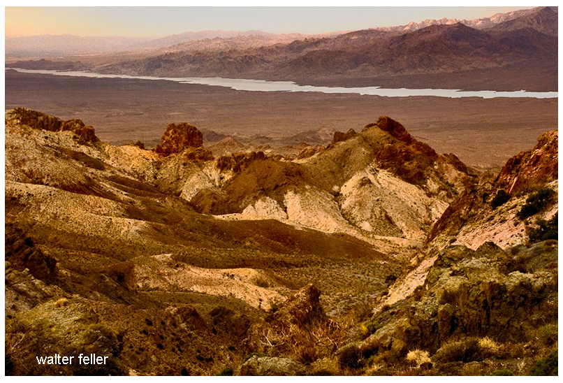
 Colorado River - Lake Mojave
In the valley of the Gila and on its tributaries from the northeast are
the Pimas, Maricopas, and Papagos. They are skilled agriculturists,
cultivating lands by irrigation. In the same region many ruined villages
are found. The dwellings of these towns in the valley were built chiefly
of grout, and the fragments of the ancient pueblos still remaining have
stood through centuries of storm. Other pueblos near the cliffs on the
northeast were built of stone. The people who occupied them cultivated
the soil by irrigation, and their hydraulic works were on an extensive
scale. They built canals scores of miles in length and built reservoirs
to store water. They were skilled workers in pottery. From the fibers of
some of the desert plants they made fabrics with which to clothe
themselves, and they cultivated cotton. They were deft artists in
picture-writings, which they etched on the rocks. Many interesting
vestiges of their ancient art remain, testifying to their skill as
savage artisans. It seems probable that the Pimas, Maricopas, and
Papagos are the same people who built the pueblos and constructed the
irrigation works; so their traditions state. It is also handed down that
the pueblos were destroyed in wars with the Apaches. In these groves of
the flood plain of the Colorado the Mojave and Yuma Indians once had
their homes. They caught fish from the river and snared a few rabbits in
the desert, but lived mainly on mesquite beans, the hearts of yucca
plants, and the fruits of the cactus. They also gathered a harvest from
the river reeds. To some slight extent they cultivated the soil by rude
irrigation and raised corn and squashes. They lived almost naked, for
the climate is warm and dry. Sometimes a year passes without a drop of
rain. Still farther to the north the Chemehuevas lived, partly along the
river and partly in the mountains to the west, where a few springs are
found. They belong to the great Shoshonian family. On the Rio Virgen and
in the mountains round about, a confederacy of tribes speaking the Ute
language and belonging to the Shoshonian family have their homes. These
people built their sheltering homes of boughs and the bast of the
juniper. In such shelters, they lived in winter, but in summer they
erected extensive booths of poles and willows, sometimes large enough
for the accommodation of a tribe of 100 or 200 persons. A wide gap in
culture separates the Pimas, Maricopas, and Papagos from the
Chemehuevas. The first were among the most advanced tribes found in the
United States; the last were among the very lowest; they are the
original "Digger" Indians, called so by all the other tribes, but the
name has gradually spread beyond its original denotation to many tribes
of Utah, Nevada, and California.

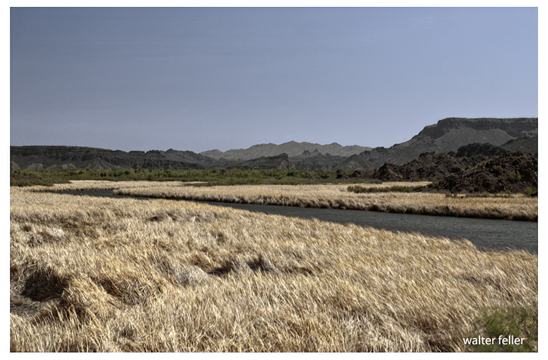
Bill Williams River
The low desert, with its desolate mountains, which has thus been
described is plainly separated from the upper region of plateau by the
Mogollon Escarpment, which, beginning in the Sierra Madre of New Mexico,
extends northwestward across the Colorado far into Utah, where it ends
on the margin of the Great Basin. The rise by this escarpment varies
from 3,000 to more than 4,000 feet. The step from the lowlands to the
highlands which is here called the Mogollon Escarpment is not a simple
line of cliffs, but is a complicated and irregular facade presented to
the southwest. Its different portions have been named by the people
living below as distinct mountains, as Shiwits Mountains, Mogollon
Mountains, Pinal Mountains, Sierra Calitro, etc., but they all rise to
the summit of the same great plateau region.
The upper region, extending to the headwaters of the Grand and Green
Rivers, constitutes the great Plateau Province. These plateaus are
drained by the Colorado River and its tributaries; the eastern and
southern margin by the Rio Grande and its tributaries, and the western
by streams that flow into the Great Basin and are lost in the Great Salt
Lake and other bodies of water that have no drainage to the sea. The
general surface of this upper region is from 5,000 to 8,000 feet above
sea level, though the channels of the streams are cut much lower.
This high region, on the east, north, and west, is set with ranges of
snow-clad mountains attaining an altitude above the sea varying from
8,000 to 14,000 feet. All winter long snow falls on its mountain-crested
rim, filling the gorges, half burying the forests, and covering the
crags and peaks with a mantle woven by the winds from the waves of the
sea. When the summer sun comes this snow melts and tumbles down the
mountain sides in millions of cascades. A million cascade brooks unite
to form a thousand torrent creeks; a thousand torrent creeks unite to
form half a hundred rivers beset with cataracts; half a hundred roaring
rivers unite to form the Colorado, which rolls, a mad, turbid stream,
into the Gulf of California.