Dunes
Dunes form wherever environmental conditions provide sand, steady wind and a location for the sand to collect. This may occur in both coastal and terrestrial settings.
Terrestrial - Land-Locked Dunes
Land-locked dune fields are fascinating geological formations that arise from a series of unique environmental processes. Sand originates as bedrock, which is weathered into large blocks capable of being transported by water. Over time, these blocks are worn down into sand-sized grains. Normally, sand and other sediments are deposited along the banks of streams, in lakes, or in oceans. However, when these water bodies dry up, such as in the case of ephemeral or seasonal streams during dry periods, or when lakes evaporate completely, the sediments are left exposed and vulnerable.In arid or semi-arid regions, where such drying is common, exposed sediments become subject to wind erosion. The wind picks up these loose sand particles and transports them until a decrease in wind speed causes the sand to be deposited. Over time, these wind-driven deposits accumulate to form extensive dune fields. The formation of these dunes is heavily influenced by the source of the sand, local wind patterns, and regional topography, which can act as natural barriers to wind flow and create deposition zones.
These land-locked dune fields, far from any water bodies, are not random accumulations but are instead the product of complex interactions between geological materials and climatic conditions. They provide critical insights into environmental changes, past climates, and wind dynamics. Moreover, they serve as unique ecosystems, hosting specialized flora and fauna adapted to these dynamic and challenging environments.
Land-locked dune fields are areas where large quantities of sand have accumulated into dunes away from coastal regions. These dunes are typically found in inland desert regions or semi-arid environments where sand supply, wind conditions, and minimal vegetation allow for the formation and maintenance of dunes.
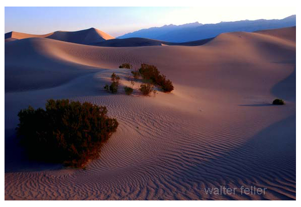
These dune fields can be striking landscapes, characterized by their shifting sands and often sparse vegetation. They are dynamic environments that change shape and location over time due to the prevailing winds. Some famous examples of land-locked dune fields include the Great Sand Dunes National Park in Colorado, USA, and the Simpson Desert in Australia.
These dune systems are not only beautiful and unique landscapes but are also important ecological zones. They provide habitats for specialized plants and animals adapted to the challenging conditions of high temperatures, shifting sands, and low water availability. Moreover, they serve as natural laboratories for studying ecological and geological processes.