Joshua Tree, California
Joshua Tree, California, has a rich and fascinating history, shaped by its unique landscape and the diverse people who have called it home.
Early Inhabitants
The area now known as Joshua Tree was originally inhabited by Native American tribes, including the Serrano, Chemehuevi, and Cahuilla. These tribes lived off the land, utilizing the desert's resources for food, shelter, and medicine. They were adept at surviving in the harsh conditions of the Mojave Desert and left behind a legacy of petroglyphs and artifacts.Exploration and Settlement
In the mid-19th century, European-American explorers and settlers began to move into the area. The California Gold Rush of the 1840s and 1850s brought prospectors to the region, hoping to find riches in the desert. While gold was discovered in some areas, the harsh conditions and remote location made large-scale mining difficult.Homesteading
In the early 20th century, the U.S. government encouraged homesteading in the area, offering land to those willing to settle and improve it. Many homesteaders arrived, building cabins and trying to eke out a living through farming and ranching. However, the arid climate and poor soil made agriculture challenging.The Birth of Joshua Tree National Park
One of the most significant events in Joshua Tree's history was the establishment of Joshua Tree National Monument in 1936, thanks to the efforts of Minerva Hoyt, a Pasadena resident and desert plant enthusiast. She recognized the beauty and ecological significance of the region and campaigned tirelessly to protect it. In 1994, the area was redesignated as Joshua Tree National Park, further securing its protection and expanding its boundaries.Development of the Community
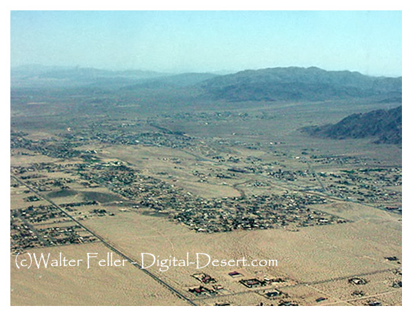
Throughout the 20th century, Joshua Tree evolved from a remote desert outpost into a small but vibrant community. The unique landscape and serene environment attracted artists, musicians, and nature enthusiasts. The establishment of Copper Mountain College and the Hi-Desert Medical Center provided essential services and educational opportunities to residents.Cultural and Spiritual Significance
Joshua Tree has long been a place of inspiration and retreat. The Joshua Tree Retreat Center, designed by Frank Lloyd Wright and his son Lloyd Wright, became a renowned center for meditation, yoga, and conferences. The area's stunning landscapes and tranquil atmosphere continue to draw people seeking spiritual and creative inspiration.Modern Joshua Tree
Today, Joshua Tree is known for its eclectic community, rich cultural offerings, and proximity to the natural wonders of Joshua Tree National Park. It remains a haven for artists, musicians, and those seeking a close-knit community in a stunning desert setting.From its early Native American inhabitants to its modern-day status as a cultural and natural landmark, Joshua Tree's history is a testament to the resilience and adaptability of those who have lived and thrived in this unique desert environment.