--
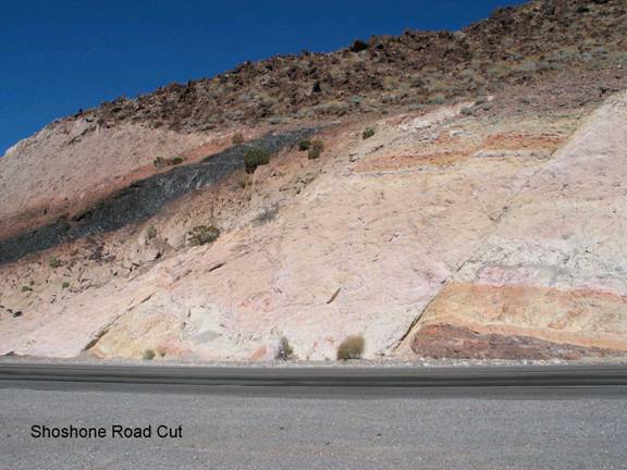
Shoshone Road Cut
SE3. Location/Access:(35o 59.810N, 116o 13.164W) This spectacular road cut is on CA 178 3.7 miles east of the junction with CA 127 which is just south of Shoshone. There is a very large parking area on the right.
Best Time: Anytime except early morning.
Geology: This is a very popular site for geology field trips and classes. Most of the rocks visible in the road cut are Tertiary and volcanic. The exceptions are the small blackish mass just to the right of the main fault at road level and the rock on the right skyline. The former rock is a mass wasting deposit composed mostly of Cambrian Bonanza King formation fragments and the skyline thin layer is a tuffaceous sandstone conglomerate. The rest of the rocks are volcanic. The dark black band is a vitrophyre and the rocks above and below it are welded rhyolite tuffs. The layers further above and below the black band are also rhyolite tuff but are not welded. The source area is probably from the late Miocene-Pliocene Timber Mountain caldera complex just northeast of here in Nevada. The main fault and its parallel and smaller sympathetic faults are all normal that strike northeast and show just a few tens of feet of displacement (Troxel and Heydari, 1982).
=-=