Aguereberry Point
NP6. Location/Access:(36o 21.543N, 117o 02.797W). This site is located 6.3 miles east of the Wildrose Road. The junction of the access road is 21 miles south of Stovepipe Wells. The road is generally well-maintained gravel, although often washboardy. There is one narrow section which may sometimes be rough. After rain or snow, the road may be muddy. High clearance is recommended.
Best Time: Afternoon, all year. In winter the air is clearer and the view better.
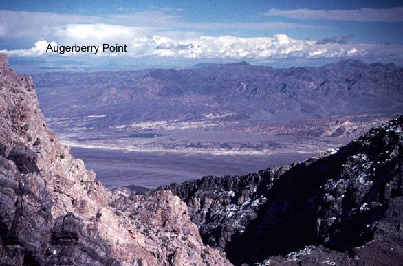
Geology: Augerberry Point is one of the four high vantage points that are accessible by vehicle listed in this guide (see also Sites GF1, CM3, FC4). En route from the pavement, you will travel over Quaternary gravels, past outcrops of the Mesozoic Skidoo granite and then through upper Proterozoic sediments of the Noonday and Johnnie formations. There are small outcrops of other lower and upper formations as well. At the summit, you will be on Cambrian Zabriskie quartzite. Not too far after leaving the pavement, you will also have passed the Eureka Mine which is more obvious on the way back. Just before the top, you will reach the ridgeline, and then the road turns left and climbs the last few hundred feet to the summit. From the parking area, walk northeast along the trail for the best view. The afternoon view of Death Valley from the point is great and forms a good compliment to the view from Dantes View (Site FC5) which is visible across the valley on the summit of the Black Mountains. The view to Badwater is obscured by the ridge in the foreground. Looking down to the northeast, the east-dipping layers of Cambrian and Ordovician sediments can be seen. Note that the much of the Cambrian section is missing. A few Neogene volcanic rocks are also visible. The Furnace Creek area is across the valley and the alluvial fan upon which the village is build is quite obvious. Outcrops of the yellow Furnace Creek formation, multi-colored Artists Drive formation and the Furnace Creek fault zone are all plainly apparent. The Funeral Mountains lie just beyond the village. Beyond the Funerals, one can see most of the way across southern Nevada. To the south, one can see down the valley past Mormon Point and all the way to the Avawatz Mountains. To the north, the Skidoo Hills and the Grapevine Mountains form the view. To the west, the higher peaks of the southern Sierra Nevada are visible on the skyline.
=-=