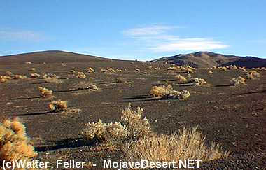
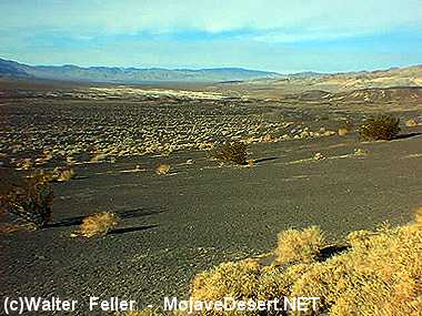
Ubehebe Crater
At the edge of Ubehebe Crater, you'll be greeted by an eerie, surreal landscape. All is quiet now, but imagine yourself
transported to a time just over two thousand years ago...
...Following weaknesses in the Earth's crust, searing basaltic magma rose upward. A
fault
along the western base of
Tin Mountain, responsible for uplift of the entire Cottonwood mountain range, lay in the path of the molten mass,
providing an easy escape route to the surface. Breaking through the bedrock below, black lava races through the
gravelly
alluvial fan
draped across the valley floor.
Fire and Water
Magma worked its way through the fault-weakened rock toward the surface. Some of Ubehebe Crater field's most
dramatic eruptions occurred when
magma
met water-soaked
bedrock
and alluvial fan
sediments.
In an instant, water flashed to steam, and a violent release of steam-powered energy blasted away the confining rock above.
(This is called a hydrovolcanic eruption.) It produced a dense, ground-hugging cloud of rocky debris which
surged out from the base at up to 100 miles/hour, decimating the landscape. A fiery fountain of lava erupted
with a roar, forming a vent to the south of what is now Ubehebe Crater. Liquid rock was thrown into the air,
then fell to the ground as solidified cinders or partially-molten
lava
blocks and bombs. A ring of black
volcanic
material soon builds around the central vent. The first of the Ubehebe Crater complex is born.
Over a dozen other explosion craters and tuff rings in the Ubehebe Crater field are the result of this type of
hydrovolcanic eruption.
The largest of these eruptions produced Ubehebe Crater, over a half a mile wide and 770 feet deep. Up to
150 feet of rock debris mantles the countryside near the site of the explosion.
Over a dozen other explosion craters and
tuff
rings in the Ubehebe Crater field are the result of this type
of hydrovolcanic eruption.
Also see:
Ubehebe Crater Interactive Satellite Photo
Volcanic Rocks & Associated Landforms
A volcano forms at an site where erupted material builds up (including lava flows, cinders, and ash). ...
Photo Tours of Craters & Lava Flow Formations
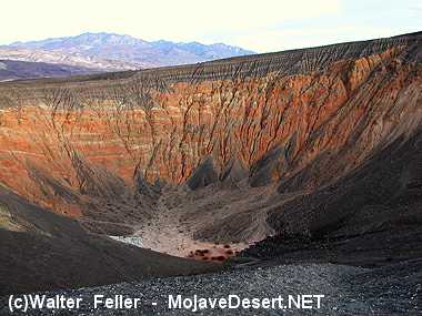
A look into the depths of Ubehebe Crater, the largest and youngest volcanic crater. The eruptions that created Ubehebe Crater blasted through older conglomerate layers, now revealed in the crater walls
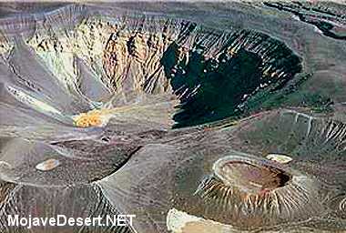
Over a dozen volcanoes dot the landscape of Ubehebe volcanic field. Ubehebe Crater is the largest and youngest volcanic feature, Little Hebe crater is at lower right. Photo by Peter Sanchez.
It produced a dense, ground-hugging cloud of rocky debris which surged out from the base at up to 100 miles/hour, decimating the landscape.