Pisgah Crater

 -
- 
Pisgah Crater is a young basaltic cinder cone that rises from the desert floor south of Interstate 40 and just off old Route 66, east of Barstow. It is one of the clearest volcanic landmarks in the central Mojave, a reminder that this part of the desert has a geologic story much younger than the surrounding mountains.
Location
 -
- 
Pisgah stands within the Lavic Lake volcanic field, where several vents align along a fissure system. The cone sits beside the old townsite of Ludlow and the former railroad and highway corridor that carried travelers across the desert long before the interstate.
Formation
 -
- 
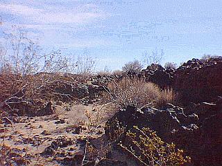
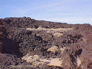
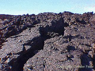
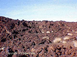
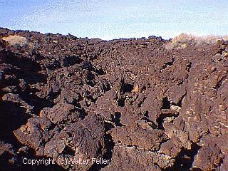
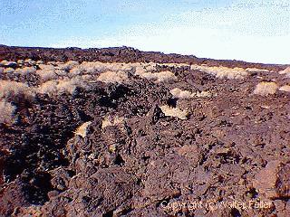
The crater was built by short, vigorous eruptions of basaltic lava. Gas-charged magma rose, burst at the surface, and threw out cinders, ash, and larger blocks that piled up to form the cone. Lava then leaked from the base and sides, spreading out in broad, dark flows. These flows show classic pahoehoe textures, pressure ridges, and collapsed crusts. The lava tubes at Pisgah formed during the final, quieter stages of these eruptions.
Age
 -
- 
Pisgah is late Pleistocene to Holocene in age. Its sharp, unweathered form suggests that the last eruptions were geologically recent. The cone and flows have not yet taken on the softened, eroded look common to older Mojave volcanoes.
Human use and disturbance
 -
- 
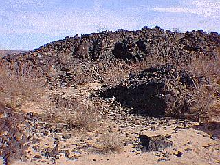
For decades the crater was quarried for cinders and basalt. Heavy machinery cut into the cone and exposed its layers, leaving a stepped appearance. Old Route 66 travelers remembered Pisgah as a dark hill beside the highway, and it served as a natural reference point across a long, open stretch of desert. Quarrying has covered or damaged parts of the lava field, including some tubes.
Surrounding landscape
 -
- 
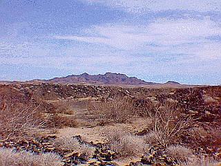
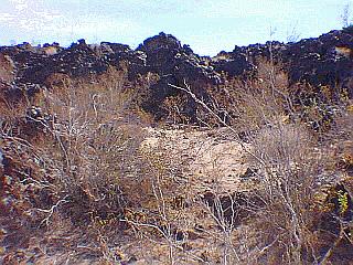
The flows reach out over a flat desert plain dotted with creosote, saltbush, and scattered sand patches. To the south lies Lavic Lake, a dry basin that once held shallow water after storms. To the east, the volcanic field continues toward the Marine Corps training ranges.
Why it matters
Pisgah Crater is a straightforward example of Mojave volcanism: a single vent, a textbook cone, and wide basalt sheets showing how fluid lava behaves in an arid environment. It ties the region to a longer volcanic history that includes Amboy Crater to the southeast and the Cima volcanic field to the northeast. It reminds visitors that the desert, for all its stillness, was shaped by forces far more active and fiery than the landscape now suggests.Pisgah Lava Tube
Pisgah Crater Geology
Pisgah Crater is a late Pleistocene to early Holocene basaltic cinder cone built along a fault-controlled line of weakness on the central Mojave Desert floor, just south of the Bristol and Cadiz basins. It rises a few hundred feet and is surrounded by a wide apron of dark lava flows that spread several miles west and southwest from the cone.The crater formed through short, vigorous Strombolian eruptions that ejected scoria, spatter, and bombs. These built the cone while low-viscosity basalt poured out at the base and moved across the desert in thin sheets. The surface shows classic aa textures: rough, broken clinker on top, dense basalt underneath, and long pressure ridges marking the movement of cooling lava.
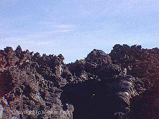
Lava tubes formed as the active flows crusted over and molten basalt drained away beneath the hardened shell. Later collapses opened skylights and revealed branching passageways. Some tubes run for hundreds of feet, giving a clear look at how the interior of a basalt flow behaved once the lava thinned and retreated downslope.
Faulting in the region helped guide the eruptions. The area lies in a transitional zone between the Basin and Range province and the Mojave structural block. Crustal stretching and block movement created fractures that allowed magma to rise quickly from depth. Pisgah itself is one of several young volcanic fields along this zone, showing how repeated tectonic strain can open small channels for localized eruptions.
The flows preserve subtle hints of age. Desert varnish is thin, soil development is limited, and the surfaces still carry sharp edges. These features mark Pisgah as geologically young. Windblown sand has begun to gather in hollows, slowly softening the rough lava. In time, these small accumulations will help tie the flows more fully into the wider desert landscape, an early sign of natures enduring adaptability over long spans of time.
Pisgah Crater sits east of Newberry Springs along old Route 66, a young volcanic feature in the central Mojave. It is a classic basaltic cinder cone with a broad apron of black lava flows spreading across the desert floor. The main cone rises roughly 300 feet above the surrounding plain, built from loose scoria and spatter thrown out during several short, vigorous eruptions late in the Pleistocene or early Holocene.
The flows form a rough, broken surface full of cracks, tubes, and collapsed chambers. The Pisgah lava tubes are the best-known part of the field, created as the outer surfaces of moving lava cooled and hardened while molten lava drained away inside. The area shows how Mojave volcanism tied into regional faulting and crustal stretching, setting the stage for small cinder cones to erupt along weak points in the landscape.
Pisgah Crater Ecology
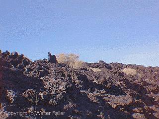
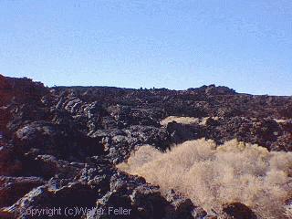
The lava field around Pisgah Crater forms a sharp break from the surrounding creosote flats. The rough basalt surface holds heat, sheds moisture quickly, and offers few pockets of soil, so plant life gathers in cracks, shaded pockets, and the margins of older flows. Creosote bush, bursage, and saltbush mark the fringe, fading as the lava becomes more severe. In sheltered traps you may find desert holly, cheesebush, or even a scattered cholla patch where dust and sand have begun to settle.Animal life is shaped by the broken terrain. Lava tubes and fissures give shelter to kangaroo rats, woodrats, pocket mice, and small predators like kit foxes and coyotes moving along the margins. Reptiles use the warm rocks heavily, especially side-blotched lizards, whiptails, and speckled rattlesnakes in the deeper cracks. Bats hunt insects around the vents and may roost in the larger tubes.
The cone itself is a perch for ravens and hawks. After storms, water can pool briefly in depressions, bringing in insects and drawing quail, thrashers, and roadrunners. Over time, windblown dust collects in the lava, slowly building thin soils. These small pockets show how desert succession takes hold in a harsh volcanic landscape, gradually tying the basalt flows back into the wider Mojave plant and wildlife community.