Fort Tejon Road
The Fort Tejon wagon road, often associated with Beale's Wagon Road, has a rich history involving the early development of overland routes in the United States, particularly in the context of connecting the southwestern territories to California. Key keywords and concepts related to the Fort Tejon wagon road include:Beale's Wagon Road:
A historic trail that began at Fort Smith, Arkansas, and continued through the New Mexico and Arizona Territories into southern California, ending at the Colorado River. It was a modest but serviceable road that covered 1,240 miles.Mojave Road
The Old Government Road leading across the Mojave Desert to the Mojave River near Forks of the Road.Edward Fitzgerald Beale:
A pivotal figure in the development of Beale's Wagon Road, Beale was appointed by President Abraham Lincoln as the Surveyor-General of California and Nevada. He is also known for his innovative use of camels in road-building expeditions across the Southwest.Camel Corps:
The use of camels in Beale's expeditions is a notable aspect of the road's history. The camels were capable of traveling for days without water and could carry much heavier loads than horses, although they were at Fort Tejon for only a short period.Fort Tejon:
Located in the Grapevine Canyon between the San Emigdio Mountains and Tehachapi Mountains, Fort Tejon was an important military outpost that played a role in the control and protection of the region. It was intermittently active from 1854 until 1864.Tejon Ranch:
After the abandonment of Fort Tejon, Edward Beale purchased the fort property and additional land surrounding it, which then became the Tejon Ranch.Rancho La Libre
These keywords encapsulate the major themes and figures associated with the Fort Tejon wagon road, highlighting its significance in the broader narrative of American westward expansion and infrastructure development.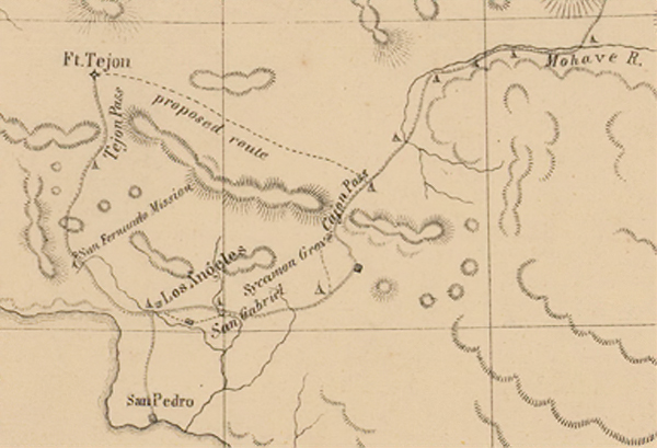
1855 map showing proposed wagon road running between the top of the West Cajon near Phelan, CA. to Fort Tejon near Gorman, CA.
OpenAI. (2024). ChatGPT (4) [Large language model]. https://chat.openai.com
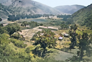
Fort Tejon
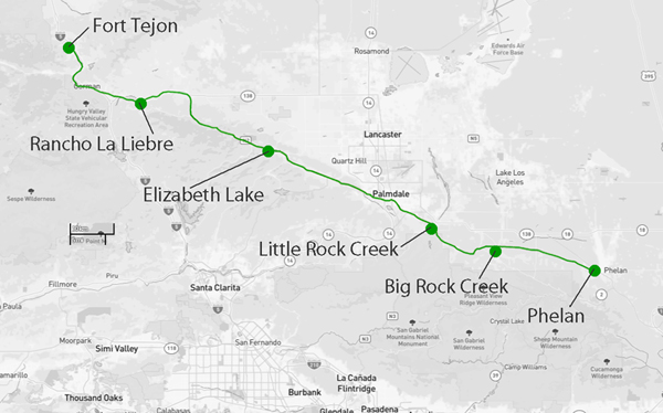 Modern map showing basic trail alignment mentioned by Jedediah Smith in his journeys
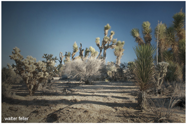
Phelan, CA.
