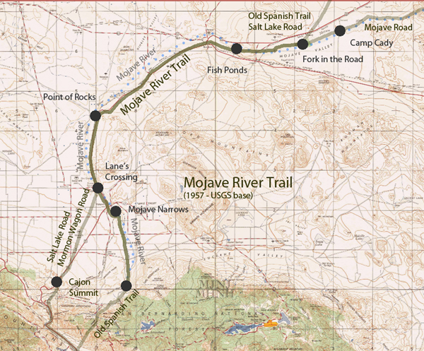
Mojave River Trail
& Wagon RoadThe Mojave River Trail brought the variations of the trails to one fairly narrow corridor along the Mojave River providing safety and support to pioneers and freighters crossing the desert.
Mojave River along Hesperia
Mojave River map
The Mojave Road followed along the river from Soda dry lake to the Cajon Pass. Desert indians used this as a trade route where water could easily be found on the way to and from the coast. Later, the Old Spanish Trail and Salt Lake Trail (Mormon Road/Trail) joined up with the river near where Daggett is today. Natural History
Formation of the Mojave River The Mojave River is the largest drainage system in the Mojave Desert. It's modern extent and capacity is only a ...
Ancestral Mojave River This model was developed to show what the Mojave River and its network of lakes may have looked like before the ...
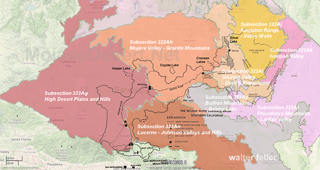
Ecosections along the Mojave River
High Desert Plains and Hills This subsection consists of the western Mojave Desert, which is mostly alluvial plain and pediment, with ...
Mojave Valley - Granite Mountains This subsection consists of about half upland, including pediments, and half alluvial plain. There are many small ...
Human History
The Broken River How the Mojave River has been foundational to our desert transportation corridors.
On the Trail of a Spanish Pioneer
Fr. Francisco Garces discovers the Mojave River in his journey across the Mojave to the San Gabriel Mission.
Discovery of the Mojave River ... but there is not the slightest doubt of Garces' discovery and present position. Mojave river has no outlet, but ...
Jedediah Smith
He is credited with being the first American to travel overland to California through the southwest and the Mojave. ...
Journal of Jedediah Smith
... he traveled along a branch of what became known as the Mojave Indian Trail, up the fickle Mojave River and into ...
Pioneer of the Mojave This is the story of Victor Valley pioneer Captain A. G. Lane, the first permanent settler on the High Desert. In 1858 Lane located at a spot about one-half mile below the lower narrows of the Mojave River. ...
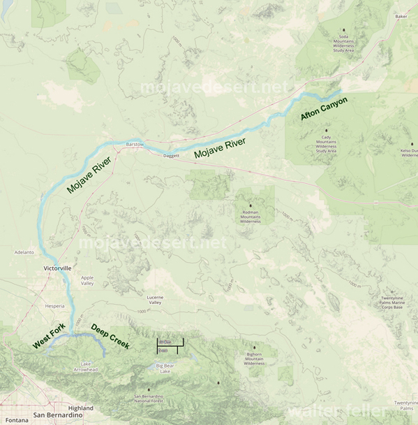
The Mojave River
Headwaters - San Bernardino MountainsTerminus (mouth) - Soda Lake (Baker, CA)
Starting Elevation ~ 3,000 ft - Ending Elevation ~ 900 ft
Length ~ 110 miles
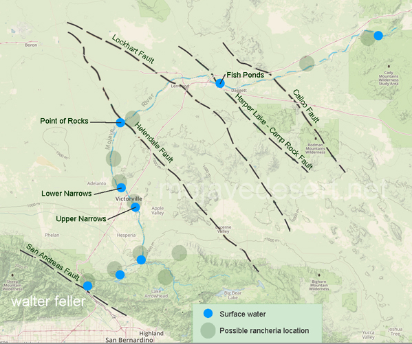
Mojave River; Fault, Groundwater, Drainage Maps
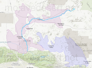
Mojave River Drainage Basin Ecology
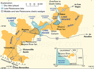
Ancestral Mojave River
