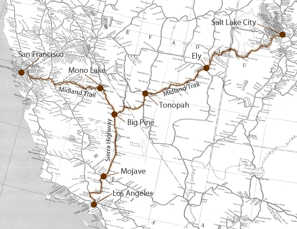
The Midland Trail
The March 1915 issue of Motor magazine contained an article by A. L. Westgard on “Motor Routes to the California Expositions.” The following is an excerpt from that article: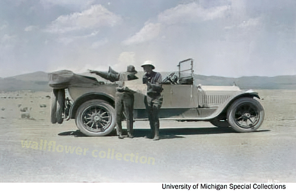
Leaving Salt Lake City, one will encounter much desert and some rather hard going to Ely, Nevada. The distance, 300 miles, is too great for one day, and, as there is no hotel accommodation between, the best the traveler can do is bunk at a ranch house displaying a sign carrying the legend "Hotel" at Kearney's Ranch . . .
. . . Leaving Ely via Murray Canyon, the traveler passes Currant Creek and crosses Railroad Valley, presumably taking its name from the fact that there is no railroad there. Arriving at Hot Creek Ranch, the tourist should call and pay his respects to Mrs. Williams, the ever cheerful good Samaritan of many a toothsome morsel dispensed with true western hospitality to tourists. At Tonopah, a live town, the tourist will find himself in the greatest silver mining camp, and at Goldfield, 25 miles further, and 211 miles from Ely, he will find the richest gold mine in the country. Though the distance may seem long, it is no trouble to run from Ely to Goldfield in a day. Leaving Goldfield, the route passes through the small mining camp of Lida, and just before entering the valley near Oasis crosses the California state line. A very good road across Gilbert summit and past Gilbert ranch, then across the level floor of a round basin, finally brings the traveler to the summit of Westgard Pass, through the White Mountains. I am justly proud of the compliment paid me by Inyo County and the State of California by giving my name to this pass. A tablet with complimentary inscription is erected at the summit. In trying to describe this most impressive gateway into California I should fail to do the beauty of the scenery full justice, so will quote literally from some literature sent out by the California-Nevada link of the Midland Trail Association: "Westerly from Westgard Pass is a view equaled in few parts of America. In the middle distance, a dozen miles away and nearly a mile below, lies the fertile Owens Valley, extending at right angles north and south over a hundred miles, and on the farther side, distant a score of miles, tower the snow-clad Sierras, with serrated crests and symmetric domes and peaks outlined against the sky at an approximate height of two and one-half miles vertical above the level of the ocean, and extending north and south far as the eye can see. The vision is rich reward for a journey of a thousand leagues."
Emerging from the pass, the route crosses Owens River Valley to Big Pine, located at the very foot of the towering Sierra Nevada Mountains. From this point one branch leads to San Francisco and one to Los Angeles. If bound for San Francisco run north up the irrigated valley 15 miles to Bishop to make a night stop. Here one will find the hospitable officers of the Inyo County Good Roads Club, of which Mr. W. G. Scott deserves special mention for his unceasing work towards the improvement of the Midland Trail. Beyond Bridgeport at the edge of Mono Lake, you take the recently opened road through Tioga Pass into the wonderful, far-famed Yosemite National Park and emerge in the San Joaquin Valley. Going up this valley to Stockton, you turn west and follow a fine road through Livermore to Oakland and San Francisco.
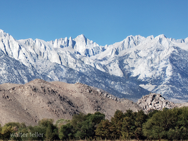
If bound for Los Angeles you turn south at Big Pine, and at Lone Pine will find Mt. Whitney, the highest mountain in the United States towering above you. Don't pass by the Eaton Chicken Farm without a stop; it is well worth while, for it is the largest "eggery" in the world. Continuing down the valley in the shadows of the Sierras, the route passes through Independence and past Owens Lake. Then it follows the new Los Angeles viaduct and arrives at Mojave, in the center of the Mojave Desert. Leaving Mojave, the road passes through a veritable forest of Joshua trees, a species of desert cactus, indigenous to this section. The route goes via Panhandle and Mint Canyon to Saugus, good going all the way. Here one strikes macadam road which leads into Los Angeles through the Newhall Grade tunnel and San Fernando.
The distance from New York to Los Angeles via this route is 3,568 miles. The hotel accommodations west of Kansas City are good at Junction City, Limon, Denver, Colorado Springs, Buena Vista, Leadville, Glenwood Springs, Grand Junction, Price, Salt Lake City, Ely, Tonopah, Goldfield and Mojave, fair at other places except at some western Kansas towns, where they are decidedly poor. Carry lunches every day west of Topeka, Kansas. Garages, gasoline and oil are available everywhere. The crossing of the Rocky Mountains is closed by snow from about October 20 to May 15th. The crossing of the Sierras is closed from November 10th to May 15th. The best months to cover this route are June, July, August and September.
Midland Trail/Lincoln Highway
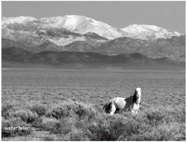
Nevada
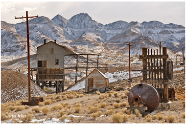
Tonopah, Nv.
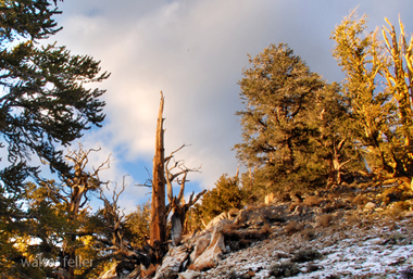
White Mountains
Mt. Whitney
